Vortigern
Studies Index


.Wansdyke Project 21
is part of
Vortigern Studies

|
|
| |

click here
|
|
Wansdyke Air Photos
Robert
Vermaat(Click
each image to enlarge it).
|
|
Maes
Knoll Iron Age camp

Maes
Knoll is an Iron Age
hillfort, triangular or
rather more Africa-shaped
when viewed from the air.
(Click here
to enlarge).
|
|
Stantonbury
Iron Age camp
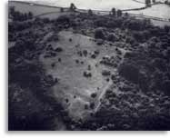
According
to Fox and Fox, the hill
top had been ploughed in
1956-7, but the land was
turning into wasteland
and going back to shrubs
in 1960. This is the
situation which is
represented by the
air-photo.
(Click here
to enlarge).
|
Morgan's
Hill
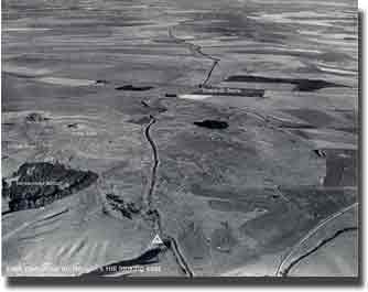
In
this picture, East
Wansdyke can be seen here
at Morgan's Hill,
separating from the Roman
Road that veers off to
the left. In the middle
distance lies Shepherds'
Shore.
(Click here
to enlarge).
|
|
Morgan's
Hill
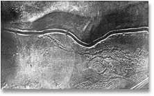
Pitt-Rivers
dug a section through
East Wansdyke in 1889
and
found Romano-British
pottery below Wansdyke,
thereby establishing its
Late or Sub-Roman date.
(Click here
to enlarge).
|
Morgan's
Hill
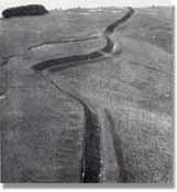
Wansdyke
has by now regained a
full view to the north
and east, as it reaches
Old Shepherds’
Shore, as we can see in
the 1956 picture.
(Click here
to enlarge).
|
|
Tan
Hill
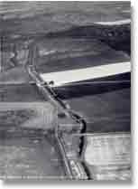
East
Wansdyke at Brown's Barn,
looking east to
Bishop's Canning Down. In
the middle distance you
can see the
Romano-British enclosure.
(Click here
to enlarge)..
|
Tan
Hill

Another
air shot of East Wansdyke
at Brown's Barn, looking
east to Bishop's Canning
Down.
(Click here
to enlarge).
|
|
Tan
Hill

East
Wansdyke at Tan Hill,
looking west to
Morgan's Hill. Left is
Roundway Down, where the
famous 1643 battle was
fought.
(Click here
to enlarge).
|
Milk
Hill

East
Wansdyke at Milk Hill,
looking west to Tan
Hill. Wansdyke is running
across the southern
escarpment of the
Marlborough Downs, with
the Vale of Pewsey in the
background.
(Click here
to enlarge).
|
|
Milk
Hill

East
Wansdyke at Milk Hill,
looking east to West
Woods and Savernake
Forest. Clearly visible
is Red Shore, where the
ancient Ridgeway passes
through Wansdyke, with
the modern road beyond.
(Click here
to enlarge).
|
New
Buildings
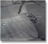
The
termination of East
Wansdyke in a field at
New Buildings Farm, 1956.
|
|
|
|
|